Report on Asian tsunami ascending the river,and its associated bank erosion and bridge failure in Sri Lanka
Last update : 03/28/2006
DAMAGE TO BRIDGES, AND NEARBY TSUNAMI TRACES
No completely washed out bridges were observed in the survey area. Most observed cases of bridge damage were at locations where the bridge joined the road. The damage resulted in damage to bridge deck slabs on the spans abutting the road.
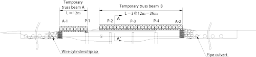
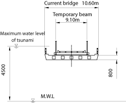
One example (Fig-4 ,Photo-4) is damage to the road bridge over Uppar Lagoon 18 km south of the Mahaweli Ganga River mouth. At this location, the deck slab was submerged to a depth of 1.3 m because water rose nearly 4.5 m from the mean sea level. It is assumed that A-1 and A-2 (dark gray in Fig-5 (a)) washed away first, with the intrusion of the tsunami into the lagoon, followed by the collapse of the deck slab (light gray in in Fig-5 (a)) from the abutment. The banks near the bridge showed less damage than would be expected (no large-scale scouring or vegetation wash-away) for such a heavily damaged bridge.
It is difficult to estimate the tsunami characteristics from this limited information. The temporal change in water level up to the maximum was relatively slow, and the water level near the maximum lasted for several dozen minutes. The damage to the bridge is attributed to this.
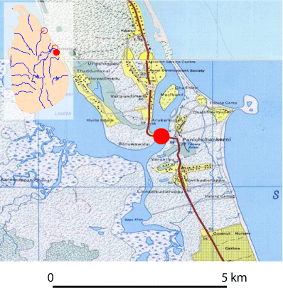
Fig-4 Uppar Lagoon Bridge and its environs.
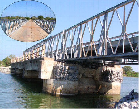
Photo-4 Uppar Lagoon Bridge.
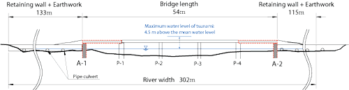
(a) Pre-disaster
(b) Post-disaster
(c) A-A'Section
Fig-5 Structural drawing of the damaged Uppar Lagoon Bridge (It is assumed that A-1 and A-2, in dark gray, washed away first, followed by the collapse of the deck slab, in light gray, from the abutment. The location is nearly 18 km south of the Mahaweli Ganga River mouth.)
- SURVEY ON TSUNAMI RUNUP IN THE RIVER
1) Yan Oya
2) Mahaweli Ganga
3) Comparison with the tsunami runup in the river in Japan - DRAINAGE OF WATER INTO SMALL CHANNELS
- DAMAGE TO BRIDGES, AND NEARBY TSUNAMI TRACES